SUMMARY: 7.5k feet to 12.5k feet, 12.7 miles
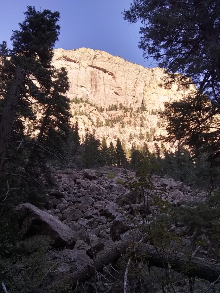

DESCRIPTION: Porvenir Canyon Trail extends from a trailhead at Porvenir Campground, through the outskirts of the camp, past a pond and over a bridge, and into the Pecos Wilderness after 1.6 miles, ascends through a lovely river canyon with high rock walls, continues to climb, eventually departs from Beaver Creek, and finally joins with Skyline Trail after 12.7 miles and a final steep ascent. The route also connects with Lone Pine Mesa Trail #214, Blue Bell Trail #101, Hermit’s Ridge Trail #101, and Hollinger Trail #219.
The route is popular with nearby Las Vegas, NM and students of New Mexico Highlands University for out-and-back day hikes.
Porvenir is Spanish for “future”.
(map coming… eventually)
GETTING THERE: Travel on NM 65, which eventually becomes FS 261, towards El Porvenir Christian Camp, but just before arriving at the camp turn right into the parking area for Porvenir Campground. This trailhead is shared with the popular and well-known Hermits Peak Trail #223.
CONDITIONS: The lower 4.5 miles of trail was entirely cleared of deadfalls and mostly lopped as of Fall, 2020. We have no information on the rest of the route at this time. No major erosion problems were observed, and the tread is visible from use by the community for the initial few miles.
NMVFO has project(s) on this trail. Update: A recent fire has likely made drastic changes.
CANCELED DUE TO FIRE DAMAGE – Hollinger Trail Backpack (Santa Fe NF)
Unsupported backpack to clear corridor and remove deadfall
El Porvenir Trail (Pecos Wilderness)
Cutting back brush and clearing deadfall from the El Porvenir Trail.
Porvenir Canyon Trail #247 (Santa Fe NF) (was Beaver Creek Trail)
Brush work along a trail near the El Porvenir Camp