The Grand Enchantment Trail runs 770 miles, from just outside Phoenix, Arizona, to the Sandia Crest in Albuquerque, NM. This route was created by one individual, Brett Tucker, by stitching together existing trails and dirt roads. He distributes an annotated set of maps, GPS tracks, and town guide, updated often. The trails used may sometimes be infrequently hiked and even more rarely maintained.
With roughly 350 miles of continuous trail in New Mexico, the GET will offer hikers challenging and often remote passages. The route passes through or near Alma, Glenwood, Mogollon, Gila Cliff Dwellings, Monticello Box, Magdalena, Socorro (alternate), Polvadera, Tajique, Chilili, Tijeras, and the Sandia Crest.

NMVFO has completed a few recent projects that happen to be on the GET.
San Lorenzo Canyon (BLM Socorro)
Build new trail and convert a user trail along San Lorenzo Canyon
Apache Kid Wilderness 2 Backpack (Magdalena RD)
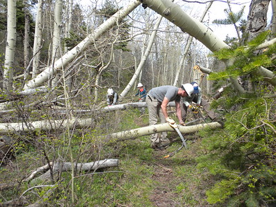
Unsupported backpack removing deadfall on the Grand Enchantment Trail in the San Mateo Mountains
Apache Kid Wilderness 1 (Magdalena RD)
Car camp near Magdalena, removing deadfall on the Grand Enchantment Trail in the San Mateo Mountains
Black Range Reroute III (Gila NF)
Worked with CDTC to build new trail on the CDT near Truth or Consequences.
Black Range Reroute II (Gila NF)
Worked with CDTC to build new trail on the CDT near Truth or Consequences.
Water Canyon CG (Magdalena RD)
Several small teams tackled geographically dispersed trails that needed deadfall removal and brushing.
Manzano Crest Trail at Capilla Peak (Mountainair RD)
Clear corridor along the Manzano Crest Trail at Capilla Peak
South Baldy Trail #11 (Magdalena RD)
Repair/redefine tread, clear brush and down fall in a part of the Cibola National Forest that is new to the NMVFO
New Canyon CG (Mountainair RD)
Re-establish tread, clear deadfall, and install signs along the Manzano Crest Trail just south of the New Canyon/Crest Trail junction.

